
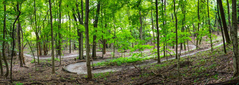
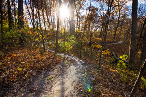
Overlooking a lower section of the North Loop descent.
Summary
Set amongst the bluffs of northern Rock Island County, Illiniwek Forest Preserve features 5 miles of ultra flowy singletrack with the longest sustained climbs and descents in the QC area. The park offers a wide range of amenities besides the off road trails and is located on the Great River Trail bike path for easy car free access.
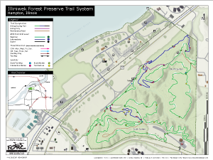
Trail Map
Trail Information
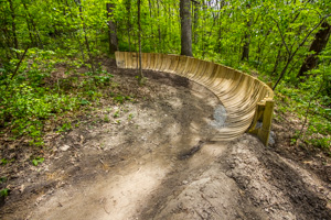
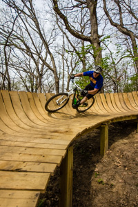
Wooden berm on the South Loop descent.
The trail system is made up of five miles of purpose built single track trail which will satisfy riders of all abilities. The trails follow the natural contours of the surrounding terrain with many overlooks of the Mississippi River Valley and the park's deep ravines. One large ravine divides the park separating the trails into two distinct systems: the North and South loops.
North Loop: Many of the trails on this side of the park provide riders with greater technical and physical challenge. Tight corners, exposed roots, and steeper grades are sure to get your heart pumping. The overlook trail meanders along one of the highest bluffs in the area and has the best views of the Mississippi River Valley in the park.
South Loop: This section of trail has great flow with minimal elevation change and is sure to put a smile on your face. Banked corners, scenic views, and ruins of old park structures are some of the features you will encounter. Be sure to ride the section behind the salt dome both ways, you will think you are going downhill the whole time.
At Illiniwek, you can't get away from climbing but what goes up must come down! Two one minute long flowy downhill runs at opposite ends of the park make the grind to the top worth it (beware of limited sight-lines around corners!). Or if climbing is your thing, it's easy to push your heart, legs, and lungs to their limit with two sustained climbs each with gains around 100 feet. One full lap of the trails (South, North, and Overlook) comes to 5.6 miles and 360 ft of elevation gain.
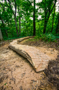
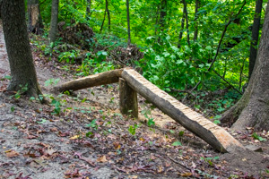
40' log ride on the upper South Loop.
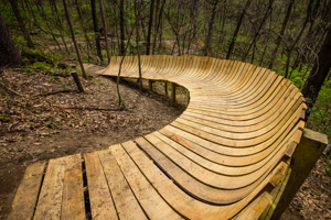
Trail Features: Starting in spring of 2014, technical trail features were started to be introduced in order to satisfy those seeking more challenging riding opportunities. Currently there are plans to build log rides, log overs, and a short section of rollers. A set of three log overs has already been completed on the north loop and a large 40' long log ride and narrow elevated skinny were recently installed on the south loop. New for 2015 are three large wooden berms which were added to the newly rerouted South Loop descent.
Travel Direction
Trails at Illiniwek have recently been signed for alternating direction by day to make the trail experience more enjoyable for all users. Cyclists and pedestrians should travel in the same direction to minimize surprise encounters. The upper loops are signed as follows:Pink Blazes - Counter Clockwise (CCW) on Mon., Wed., Fri., and Sun.
Blue Blazes - Clockwise (CW) on Tues., Thurs., and Sat.
Sticking to the route is especially important during periods of high use (after work during the week and on weekends). Please be aware of these changes. It will probably be hard to forget with new signs present at every intersection as a reminder.
The uphill and downhill trails have also been signed for one way only travel. See the trail map above for more information about these changes.
Park Hours
- Trails open daily 1/2 hour before sunrise and close at 10:00 pm. Be off the trails and ready to leave before 10pm.
- Campground open from April 1st to October 31st.
Trail Closures
Trails at Illiniwek are closed to all users when wet and muddy to prevent damage. Trail closures are controlled by Illiniwek park staff but are relayed to us and are displayed on the trail status in the upper left hand corner of this page. For current conditions you can also call the park office at 309-496-2620 or check the Illiniwek Facebook Page. Trails are typically closed for 24 hours or more after 0.20" or greater rainfall and during freeze thaw cycles in winter months as necessary.
Directions
Just North of Hampton, IL on IL-84 or 2.2 miles west of I-80 on IL-84 (take the first/last exit entering/exiting Illinois).
Trail Photos
 Wood berm#3 on the South Loop descent trail. |
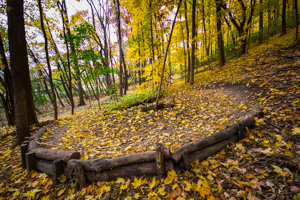
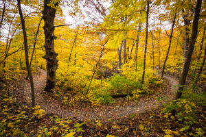 Upper South Loop in fall. |
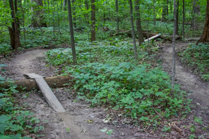 Log overs on the upper North Loop. |
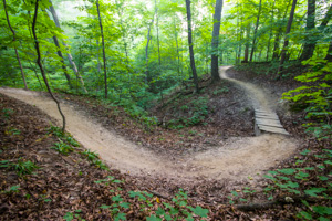 Small trail bridge on the upper South Loop. |
 Log ride on the Upper South Loop. |
 One of the many trail berms. This one is on the North Loop descent. |
 Meandering trail along the upper South Loop. |
 Upper South Loop in fall. |
 Wood berms on the South Loop descent. Russhole for scale. |
More Info
Illiniwek Forest Preserve blankets 199 acres of hardwood deciduous forest and is located on the Mississippi River just north of Hampton, Illinois. Features include on-site primitive and modern camping, fishing, access to the Great River Trail, and mountain bike and hiking trails.
See Rock Island County's Forest Preserve District website for more information.
Also, check out the Park's Facebook page for the most current trail conditions, events, or to leave park staff questions/comments: Illiniwek Facebook Page
